
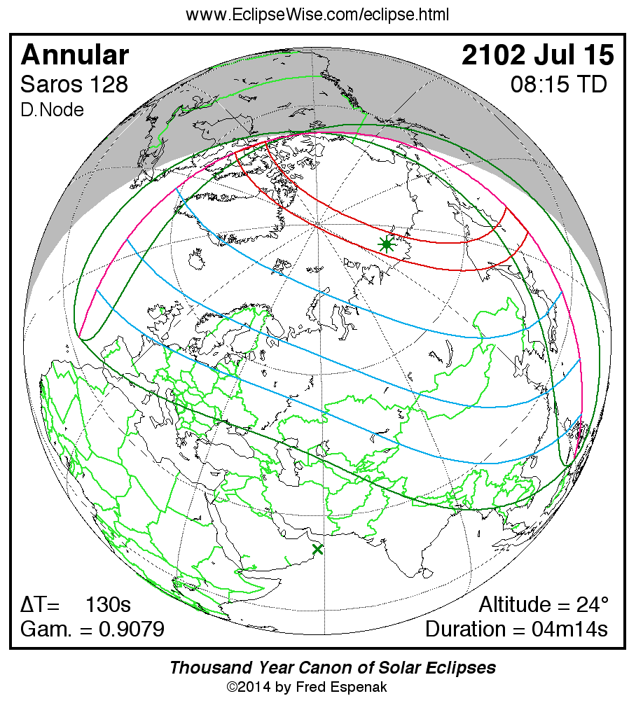
Path of the Annular Solar Eclipse of 2102 Jul 15
Fred Espenak
Introduction
The following table delineates the path of the Moon's antumbral shadow during the Annular Solar Eclipse of 2102 Jul 15 . The geographic coordinates (WGS 84) of the northern and southern limits and the central line are listed at 120-second intervals. This provides adequate detail for making plots of the path on larger scale maps. Local circumstances on the central line include the ratio of the apparent diameters of the Moon to the Sun, the Sun's altitude and azimuth (degrees), the path width (kilometers) and the duration on the central line (minutes and seconds). See the Explanation of the Central Eclipse Path Table for a description of each column in the table.
The geographic visibility of the eclipse is shown on a global map on the Prime Page for the Eclipse which also includes complete details on the eclipse. The path of the eclipse is displayed in greater detail on an interactive Google Map .
| Annular Solar Eclipse of 2102 Jul 15 | |||||||||||
| UT1 | Northern Limit | Southern Limit | Central Line | M:S | Sun | Sun | Path | Central | |||
| Latitude | Longitude | Latitude | Longitude | Latitude | Longitude | Ratio | Alt. | Azm. | Width | Duration | |
| Limits | 67°33.4'N | 093°48.6'W | 65°33.4'N | 078°34.1'W | 66°37.8'N | 085°31.6'W | 0.934 | 0° | - | 706 km | 03m54.6s |
| 07:26 | - | - | 77°35.3'N | 065°43.8'W | 72°51.0'N | 080°17.3'W | 0.935 | 6° | 28° | 663 km | 03m59.2s |
| 07:28 | - | - | 79°23.1'N | 063°53.6'W | 75°42.2'N | 078°46.0'W | 0.936 | 9° | 30° | 641 km | 04m01.4s |
| 07:30 | 70°14.9'N | 092°02.6'W | 81°00.7'N | 062°07.6'W | 77°55.1'N | 078°07.4'W | 0.937 | 11° | 31° | 624 km | 04m03.0s |
| 07:32 | 74°35.7'N | 090°55.1'W | 82°30.9'N | 060°18.8'W | 79°48.5'N | 078°06.8'W | 0.937 | 13° | 32° | 610 km | 04m04.3s |
| 07:34 | 77°08.9'N | 091°44.1'W | 83°55.3'N | 058°18.1'W | 81°29.4'N | 078°45.3'W | 0.937 | 14° | 32° | 598 km | 04m05.5s |
| 07:36 | 79°09.3'N | 093°40.6'W | 85°15.1'N | 055°50.3'W | 83°01.3'N | 080°13.6'W | 0.938 | 16° | 31° | 588 km | 04m06.5s |
| 07:38 | 80°50.4'N | 096°48.5'W | 86°30.8'N | 052°22.4'W | 84°25.7'N | 082°56.2'W | 0.938 | 17° | 29° | 579 km | 04m07.4s |
| 07:40 | 82°17.1'N | 101°25.6'W | 87°42.6'N | 046°18.0'W | 85°43.2'N | 087°45.9'W | 0.938 | 18° | 25° | 571 km | 04m08.2s |
| 07:42 | 83°30.7'N | 108°01.3'W | 88°48.5'N | 030°20.3'W | 86°52.7'N | 096°44.1'W | 0.938 | 19° | 17° | 564 km | 04m09.0s |
| 07:44 | 84°30.4'N | 117°13.0'W | 89°22.9'N | 040°53.0'E | 87°48.7'N | 114°36.4'W | 0.939 | 19° | 360° | 559 km | 04m09.6s |
| 07:46 | 85°13.3'N | 129°29.2'W | 88°37.5'N | 094°07.1'E | 88°15.6'N | 147°29.7'W | 0.939 | 20° | 328° | 554 km | 04m10.2s |
| 07:48 | 85°35.8'N | 144°25.5'W | 87°36.2'N | 106°14.1'E | 87°58.0'N | 177°57.1'E | 0.939 | 21° | 294° | 549 km | 04m10.8s |
| 07:50 | 85°35.9'N | 160°07.3'W | 86°34.0'N | 111°17.1'E | 87°11.8'N | 158°15.7'E | 0.939 | 21° | 275° | 545 km | 04m11.3s |
| 07:52 | 85°15.9'N | 174°08.4'W | 85°32.3'N | 114°11.2'E | 86°15.5'N | 148°18.8'E | 0.939 | 22° | 266° | 542 km | 04m11.7s |
| 07:54 | 84°41.1'N | 174°46.3'E | 84°31.6'N | 116°10.1'E | 85°15.9'N | 142°49.6'E | 0.939 | 22° | 262° | 540 km | 04m12.1s |
| 07:56 | 83°56.8'N | 166°30.6'E | 83°31.7'N | 117°40.1'E | 84°15.6'N | 139°32.3'E | 0.939 | 23° | 259° | 538 km | 04m12.4s |
| 07:58 | 83°06.8'N | 160°27.4'E | 82°32.6'N | 118°52.9'E | 83°15.2'N | 137°26.9'E | 0.939 | 23° | 258° | 536 km | 04m12.7s |
| 08:00 | 82°13.4'N | 155°59.8'E | 81°34.3'N | 119°54.8'E | 82°15.2'N | 136°04.4'E | 0.940 | 23° | 258° | 535 km | 04m13.0s |
| 08:02 | 81°18.0'N | 152°40.7'E | 80°36.6'N | 120°49.2'E | 81°15.7'N | 135°09.3'E | 0.940 | 24° | 258° | 535 km | 04m13.2s |
| 08:04 | 80°21.5'N | 150°10.9'E | 79°39.6'N | 121°38.4'E | 80°16.6'N | 134°32.8'E | 0.940 | 24° | 258° | 534 km | 04m13.3s |
| 08:06 | 79°24.3'N | 148°16.1'E | 78°43.0'N | 122°23.6'E | 79°17.9'N | 134°09.5'E | 0.940 | 24° | 259° | 535 km | 04m13.5s |
| 08:08 | 78°26.8'N | 146°48.3'E | 77°46.9'N | 123°05.9'E | 78°19.8'N | 133°55.8'E | 0.940 | 24° | 259° | 535 km | 04m13.5s |
| 08:10 | 77°29.0'N | 145°41.0'E | 76°51.2'N | 123°46.0'E | 77°22.0'N | 133°49.4'E | 0.940 | 24° | 260° | 537 km | 04m13.6s |
| 08:12 | 76°31.1'N | 144°49.7'E | 75°55.9'N | 124°24.4'E | 76°24.5'N | 133°48.9'E | 0.940 | 24° | 261° | 538 km | 04m13.6s |
| 08:14 | 75°33.2'N | 144°11.1'E | 75°00.8'N | 125°01.6'E | 75°27.3'N | 133°52.9'E | 0.940 | 24° | 262° | 540 km | 04m13.6s |
| 08:16 | 74°35.1'N | 143°42.8'E | 74°05.9'N | 125°37.9'E | 74°30.2'N | 134°00.8'E | 0.940 | 24° | 263° | 543 km | 04m13.5s |
| 08:18 | 73°37.0'N | 143°23.2'E | 73°11.2'N | 126°13.5'E | 73°33.4'N | 134°12.0'E | 0.940 | 24° | 264° | 545 km | 04m13.4s |
| 08:20 | 72°38.7'N | 143°11.0'E | 72°16.5'N | 126°48.7'E | 72°36.6'N | 134°26.0'E | 0.940 | 24° | 265° | 549 km | 04m13.2s |
| 08:22 | 71°40.2'N | 143°05.0'E | 71°22.0'N | 127°23.7'E | 71°39.8'N | 134°42.7'E | 0.940 | 24° | 266° | 552 km | 04m13.0s |
| 08:24 | 70°41.4'N | 143°04.7'E | 70°27.3'N | 127°58.7'E | 70°42.9'N | 135°01.7'E | 0.940 | 24° | 268° | 556 km | 04m12.8s |
| 08:26 | 69°42.3'N | 143°09.5'E | 69°32.6'N | 128°33.8'E | 69°46.0'N | 135°23.0'E | 0.940 | 23° | 269° | 561 km | 04m12.5s |
| 08:28 | 68°42.8'N | 143°19.0'E | 68°37.8'N | 129°09.3'E | 68°48.8'N | 135°46.5'E | 0.939 | 23° | 270° | 566 km | 04m12.2s |
| 08:30 | 67°42.7'N | 143°33.2'E | 67°42.8'N | 129°45.3'E | 67°51.3'N | 136°12.3'E | 0.939 | 23° | 271° | 571 km | 04m11.9s |
| 08:32 | 66°42.0'N | 143°51.1'E | 66°47.4'N | 130°22.0'E | 66°53.4'N | 136°40.3'E | 0.939 | 22° | 273° | 577 km | 04m11.5s |
| 08:34 | 65°40.5'N | 144°14.2'E | 65°51.7'N | 130°59.6'E | 65°55.0'N | 137°10.6'E | 0.939 | 22° | 274° | 583 km | 04m11.1s |
| 08:36 | 64°37.9'N | 144°41.4'E | 64°55.6'N | 131°38.3'E | 64°55.9'N | 137°43.4'E | 0.939 | 21° | 275° | 590 km | 04m10.6s |
| 08:38 | 63°34.2'N | 145°13.4'E | 63°58.9'N | 132°18.3'E | 63°56.2'N | 138°18.9'E | 0.939 | 21° | 277° | 598 km | 04m10.1s |
| 08:40 | 62°28.9'N | 145°50.6'E | 63°01.6'N | 132°59.8'E | 62°55.5'N | 138°57.3'E | 0.939 | 20° | 278° | 605 km | 04m09.5s |
| 08:42 | 61°21.9'N | 146°33.6'E | 62°03.4'N | 133°43.1'E | 61°53.7'N | 139°39.1'E | 0.939 | 20° | 279° | 614 km | 04m08.9s |
| 08:44 | 60°12.4'N | 147°23.3'E | 61°04.4'N | 134°28.6'E | 60°50.5'N | 140°24.5'E | 0.938 | 19° | 281° | 622 km | 04m08.3s |
| 08:46 | 59°00.0'N | 148°21.1'E | 60°04.2'N | 135°16.6'E | 59°45.7'N | 141°14.4'E | 0.938 | 18° | 282° | 631 km | 04m07.6s |
| 08:48 | 57°43.7'N | 149°29.1'E | 59°02.8'N | 136°07.6'E | 58°38.9'N | 142°09.4'E | 0.938 | 17° | 284° | 641 km | 04m06.8s |
| 08:50 | 56°21.7'N | 150°50.7'E | 57°59.7'N | 137°02.2'E | 57°29.5'N | 143°10.8'E | 0.938 | 16° | 285° | 651 km | 04m05.9s |
| 08:52 | 54°51.3'N | 152°32.6'E | 56°54.7'N | 138°01.2'E | 56°16.8'N | 144°20.0'E | 0.937 | 15° | 287° | 661 km | 04m05.0s |
| 08:54 | 53°06.0'N | 154°49.5'E | 55°47.4'N | 139°05.5'E | 54°59.7'N | 145°39.6'E | 0.937 | 13° | 289° | 671 km | 04m03.9s |
| 08:56 | 50°40.8'N | 158°38.4'E | 54°37.0'N | 140°16.6'E | 53°36.4'N | 147°13.8'E | 0.937 | 12° | 291° | 681 km | 04m02.7s |
| 08:58 | - | - | 53°22.6'N | 141°36.6'E | 52°03.3'N | 149°10.4'E | 0.936 | 10° | 293° | 691 km | 04m01.3s |
| 09:00 | - | - | 52°02.9'N | 143°08.7'E | 50°12.2'N | 151°48.4'E | 0.936 | 7° | 295° | 699 km | 03m59.5s |
| 09:02 | - | - | 50°35.2'N | 144°58.7'E | 47°19.6'N | 156°47.8'E | 0.934 | 3° | 299° | 703 km | 03m56.5s |
| Limits | 48°14.7'N | 163°35.1'E | 43°39.5'N | 156°50.6'E | 45°51.0'N | 159°56.7'E | 0.934 | 0° | - | 701 km | 03m54.8s |
ΔT = 129.6 seconds
| Greatest Eclipse and Greatest Duration | ||||||||
| Event | Time TD |
Time UT1 |
Latitude | Longitude | Sun Altitude |
Sun Azimuth |
Path Width | Central Duration |
| Greatest Eclipse | 08:15:13.6 | 08:13:03.9 | 75°54.0'N | 133°18.0'E | 24.4° | 261.5° | 539.1 km | 04m13.58s |
| Greatest Duration | 08:13:19.0 | 08:11:09.4 | 76°48.7'N | 133°48.5'E | 24.3° | 260.5° | 537.4 km | 04m13.60s |
Links for the Annular Solar Eclipse of 2102 Jul 15
Links to Additional Solar Eclipse Predictions
- Home - home page of EclipseWise with predictions for both solar and lunar eclipses
- Solar Eclipses - primary page for solar eclipse predictions
- Solar Eclipse Links - detailed directory of links
Eclipse Predictions
Predictions for the Annular Solar Eclipse of 2102 Jul 15 were generated using the JPL DE406 solar and lunar ephemerides. The lunar coordinates were calculated with respect to the Moon's Center of Mass. Although the predictions are first calculated in Terrestrial Dynamical Time (TD), they are then converted to Universal Time (UT1) as presented here. The parameter ΔT is used to convert between the two times (i.e., UT1 = TD - ΔT). ΔT has a value of 129.6 seconds for this eclipse. The uncertainty in ΔT is 21.2 seconds corresponding to a standard error in longitude of the eclipse path of ± 0.09°.
Acknowledgments
All eclipse calculations are by Fred Espenak, and he assumes full responsibility for their accuracy.
Permission is granted to reproduce eclipse data when accompanied by a link to this page and an acknowledgment:
"Eclipse Predictions by Fred Espenak, EclipseWise.com"
The use of diagrams and maps is permitted provided that they are unaltered (except for re-sizing) and the embedded credit line is not removed or covered.