
Atlas of Solar Eclipses in North America
Fred Espenak
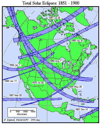
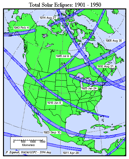
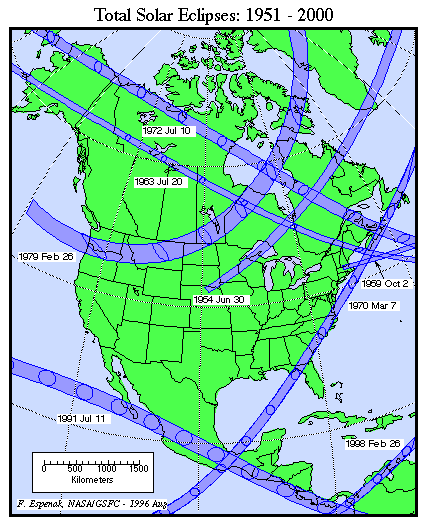
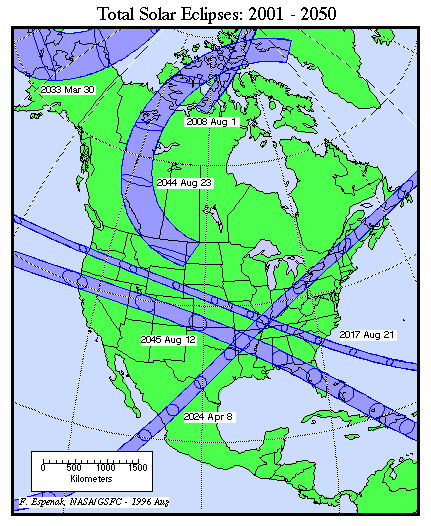
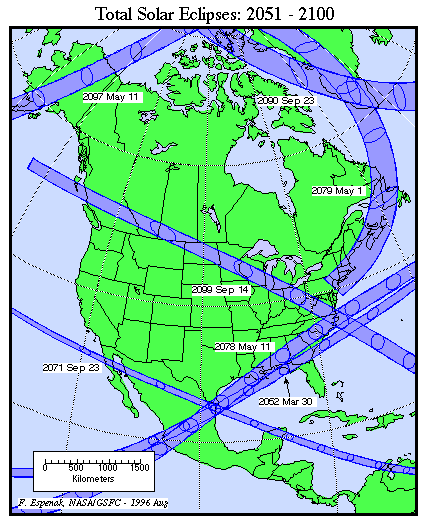
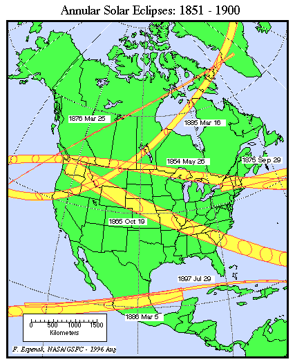
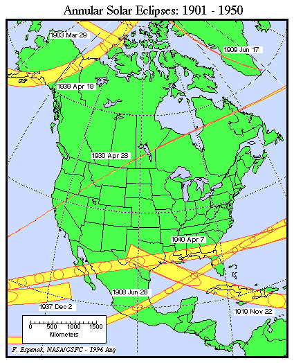
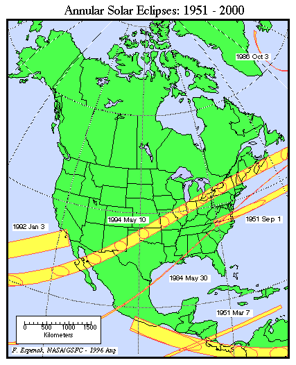
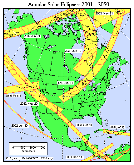
The following maps show the path of every total or annular solar eclipse visible from North America during the 19th, 20th and 21st centuries. The maps are broken down into 50 year periods and are organized by eclipse type (total or annular). Each map is stored as a gif of 82 to 86 kilobytes.
- Total Solar Eclipses: 1851-1900
- Total Solar Eclipses: 1901-1950
- Total Solar Eclipses: 1951-2000
- Total Solar Eclipses: 2001-2050
- Total Solar Eclipses: 2051-2100
- Annular Solar Eclipses: 1851-1900
- Annular Solar Eclipses: 1901-1950
- Annular Solar Eclipses: 1951-2000
- Annular Solar Eclipses: 2001-2050
- Annular Solar Eclipses: 2051-2100
Links to Solar Eclipse Predictions
- World Atlas of Solar Eclipse Maps - index page
- Six Millennium Catalog of Solar Eclipses - covers the years -2999 to +3000 (3000 BCE to 3000 CE)
- Javascript Solar Eclipse Explorer - calculate all solar eclipses visible from a city
- Thousand Year Canon of Solar Eclipses 1501 to 2500 - link to the publication
- MrEclipse.com - eclipse resources and tips on photography
- Solar Eclipses for Beginners - a primer on solar eclipse basics
- MrEclipse Photo Index - an index of solar eclipse photographs
Eclipse Predictions
Predictions for the solar eclipse paths were generated using the VSOP87/ELP2000-82 solar and lunar ephemerides. The lunar coordinates have been calculated with respect to the Moon's Center of Mass. They DO NOT include a correction to the Center of Figure, or the effects of mountains and valleys along the edge of the Moon.
Acknowledgments
All eclipse calculations are by Fred Espenak, and he assumes full responsibility for their accuracy. Permission is granted to reproduce eclipse data when accompanied by a link to this page and an acknowledgment:
"Eclipse Predictions by Fred Espenak, EclipseWise.com"
The use of diagrams and maps is permitted provided that they are NOT altered (except for re-sizing) and the embedded credit line is NOT removed or covered.